Whatever map tiles are in iPhoto for iOS, they don’t look like Google Maps:

Apple, back in 2009, bought PlaceBase, a mapping company. Rumors have been circulating for years that Apple was developing its own mapping solution. Last year, the company bought C3 Technologies, a group working on 3D map tiles.
The desktop version of iPhoto uses standard Google Maps:

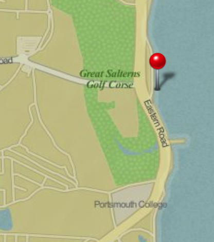
These two images show the same location. The top one — Google Maps, in desktop iPhoto — is more accurate, showing the land correctly, and labeling the golf course a “Recreation Ground,” as it is known today. The second image, from iPhoto on iOS, isn’t as accurate, and has the old name:

Here’s the same location, from Google Maps online:

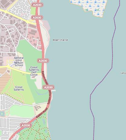
Some have suggested that these tiles are from OpenStreetMap, but they don’t look like they are from that source, either. Here’s the above location from OpenStreetMap’s database:
Update 1: The Next Web agrees.
Update 2: It seems that this has been confirmed by Holger Eilhard, via The Verge.
Update 3: John Gruber:
OK, what I’m hearing now is that Places still uses Google Maps, but the maps in Journals and slideshows are not using Google Maps, and are Apple’s own stuff.
Update 4: More on OpenStreetMap